
A Guide’s Life: Bright Days & Dark Skies
It’s International Dark Sky week! My recent adventure in the Boundary Waters was marked by incredible night skies. Far from any light pollution, we were able to enjoy the stars, planets and moon that filled the quiet lake we were on.
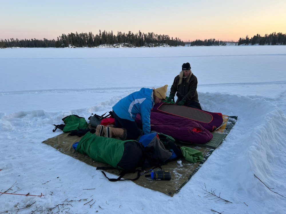
We laid on the ice, snug in our sleeping bags atop layers of pads and waxed canvas. Earlier, one person had built a wind block to the south and west, shielding us from the mild-but-persistent breeze.
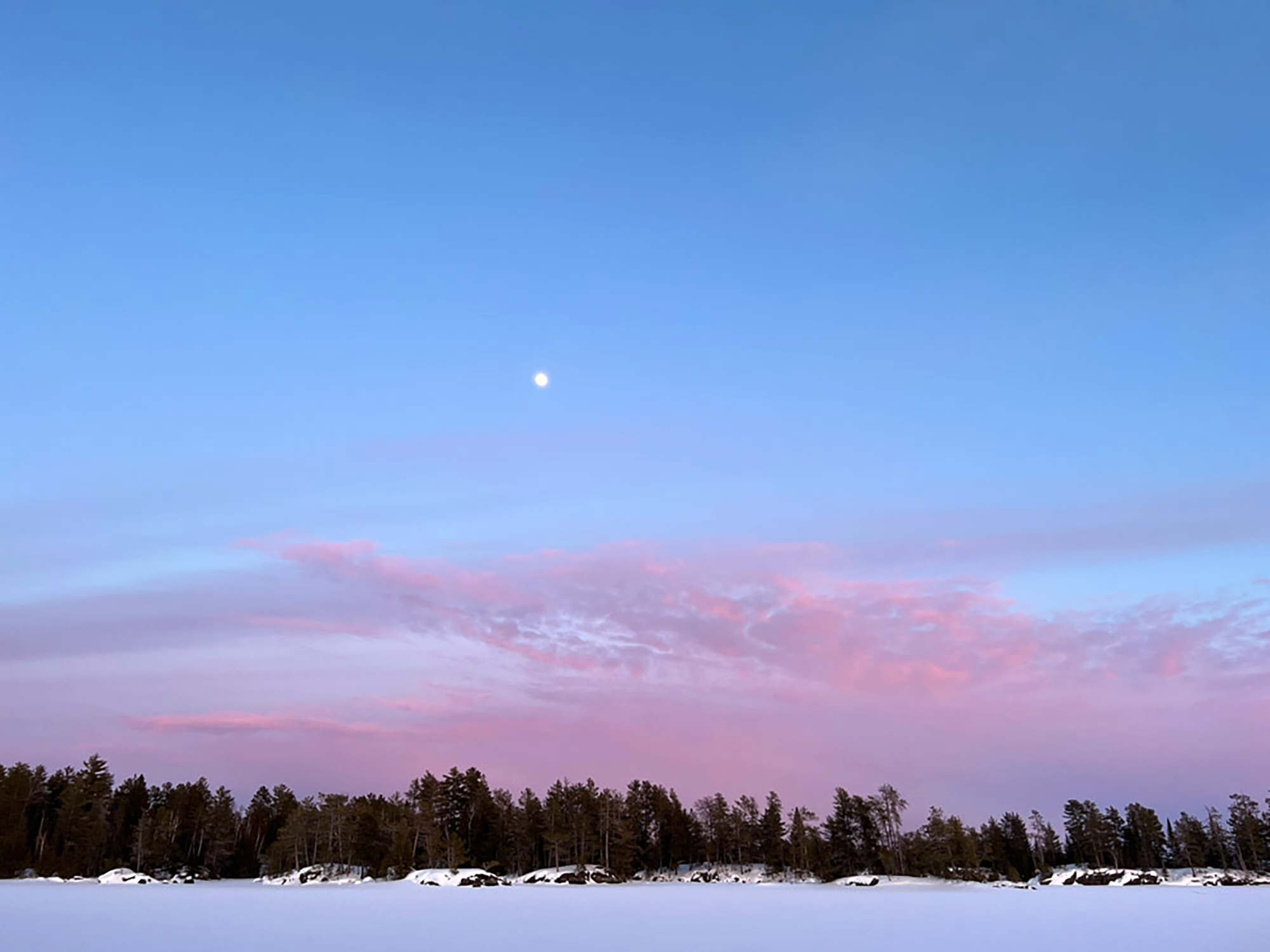
Jupiter and Saturn had risen first from the southwest. Brilliant, blue light cast over the ground from the nearly full moon. It scattered light so well that we hardly used our headlamps. Stars sparkled and the occasional satellite shot across the sky. As I laid there under the big bowl of night, I could hardly fall asleep with so much beauty around me.
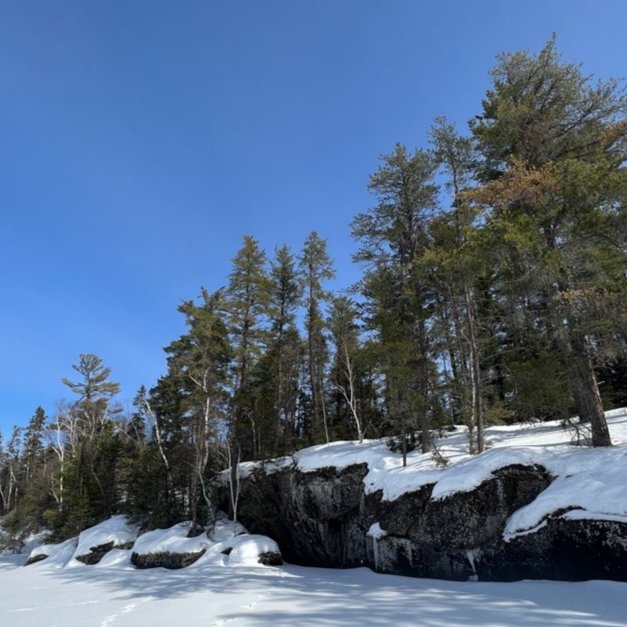
The Boundary Waters Canoe Area (BWCA) in northern Minnesota is a million acre wilderness, where I work as a seasonal guide. During the winter, I take folks winter camping. During the other seasons, I take them on canoe trips, exploring some of the 2,000 waterways that dot the landscape. The campsites sit perched on massive gray slabs of igneous rock, and we gaze in awe at the intricate ways they form cascades and islands throughout the area.
"In 2020, the International Dark-Sky Association designated the BWCAW as a Dark Sky Sanctuary, one of twelve such locations in the world and only four in the United States. At 1.1 million acres, it’s the largest. This speaks, of course, to its remoteness and to its protected status." - Friends of the Boundary Waters

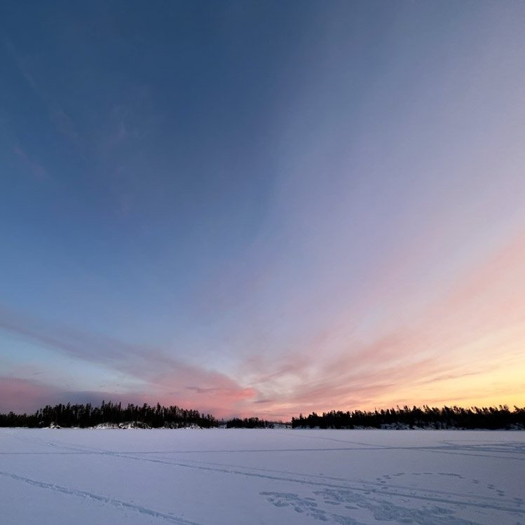
Early evening, Lake One.
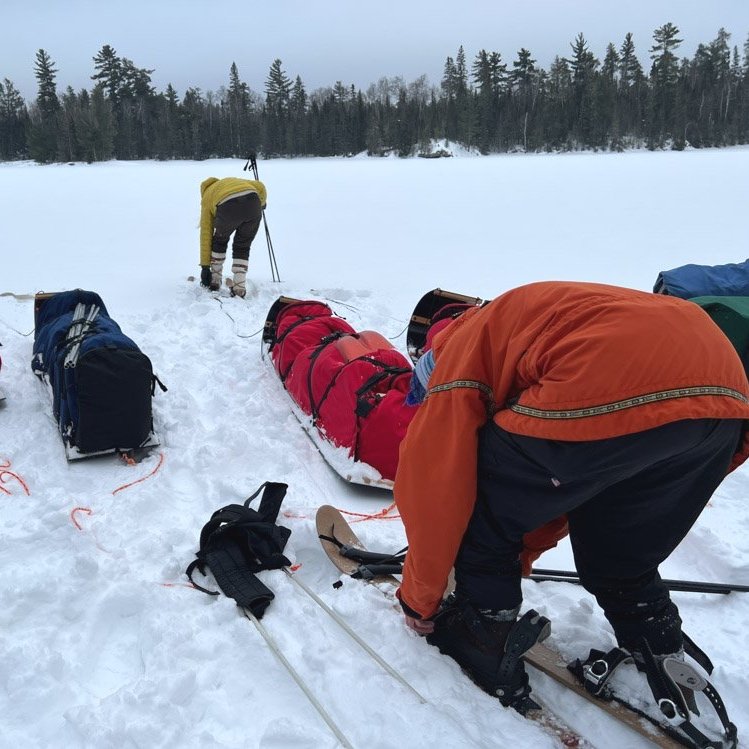
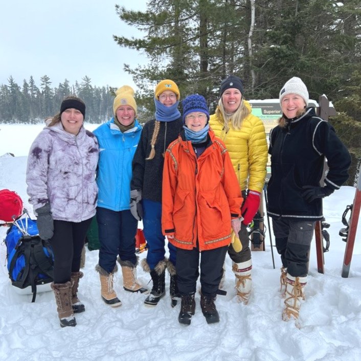
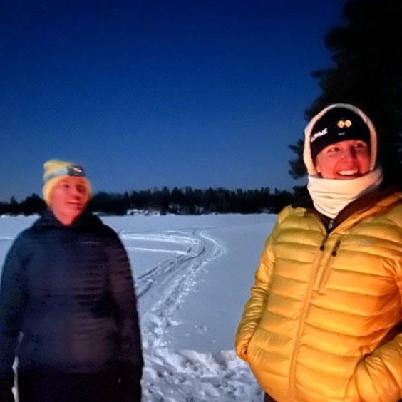
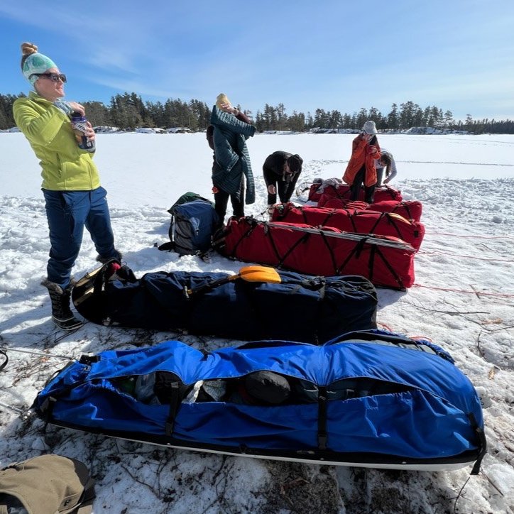
Our group was safely tucked back in a quiet bay on Lake One. We had begun our journey back in the small town of Ely. Ely is a “dead end” town, meaning that beyond it, are a few main arteries out of town that head in to the woods, eventually leading to entry points and the boundary of the wilderness. The night before, five women had come to the outfitter and dropped their bags in the bunkhouse. A short while later we met in the main building so that I could provide and orientation. The six toboggans were mostly packed, but we’d finish packing them with their gear. Over a couple of hours I talked about the Boundary Waters, why it’s unique and what they could expect. Some women want me to take a closer look at their gear and weed out unnecessary items. A few are trying to make decisions about layers for the first day. Everyone is sized for the short, wide, backcountry skis. Anticipation is palpable. Even I get excited as some things will feel very familiar, but I ponder what might be new and unknown.


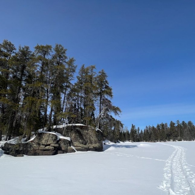
Travel through Lake One narrows.
Entering the Wilderness
The following morning, everyone is up by 6am. A looming pile of packed toboggans, skis, poles, day packs and snow shovels is hauled and packed into two vehicles and a trailer. Thirty-five minutes later, we are at the very end of Fernberg Road. There is nowhere else to go. We whiz by a large customs sign that talks about folks coming to or from Canada need to possess the proper paperwork and stop at customs in town. The BWCA is aptly named, as it shares waters with Canada. Anywhere the boundary of the two countries follows the border, the water is shared. Canoeists often use Ely as a jump-off point to access Quetico, another million acre wilderness of remote waterways and campsites.
The entry point has been freshly plowed and a large, 6’ bank of snow greets us as we haul and shove the heavy toboggans up and over it, gently guiding the sleds down to the lake. Everything is double-checked to be sure we haven’t left anything behind.
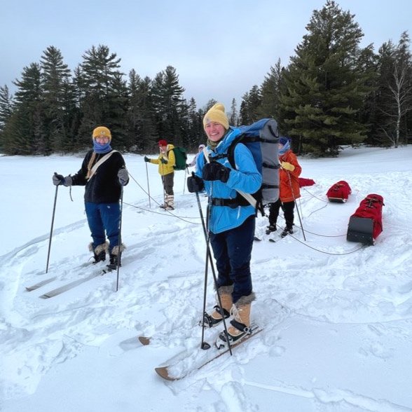
As the group clips into their skis and lashes a tump line across their chests, I take a bearing. Having been here numerous times, I know where to go, but it’s always good practice to check. I expected to see tracks of other winter campers or maybe a musher, but the snow covered ground is pristine. Nobody has been here for a while, which means we’ll be breaking trail.
I head off to the left, following the shoreline in order to avoid the soft-water route that tends to stay open, no matter the temps. The skis do a pretty good job of keeping me aloft, and I probably only sink down about a half-foot. It will be slow-going, but the temps are comfortable at around 20º, and I have two light layers on. About a mile later, I cut through an otter slide. It looks like someone rolled a bowling ball in the snow, except that every ten feet or so are otter tracks. It’s a morse code of glide, run, glide and repeat. The clouds slowly start to burn off and as we pause every half-hour for a break, the sun pushes through, flooding us with warmth. The landscape goes from muted grays to deep green pines set against a cerulean blue. Even our bright red and blue toboggans seem cheerier against the pristine, white snow.
We spend about two hours traveling south, down into the main body of Lake One. Lake One has classic BWCA features, very angular with lots of finger bays and islands. No perfect circles here. I check my topographic map a few times and spy the arm of the lake that holds a few campsites. Before our trip, I had done some research on a few potential sites. Knowing two were located somewhat close together, I went for those. I’d also been told that Confusion Creek drained in the bay and would likely be open, possibly attracting wildlife. A bonus for us!
By 11:30am, we’d come to the shoreline that one of the campsites was located. At a glance, it looked unremarkable. One would never know a campsite lay deeply buried beneath four feet of snow. After many years of travel, I’ve learned to identify what likely is a site and what is not.
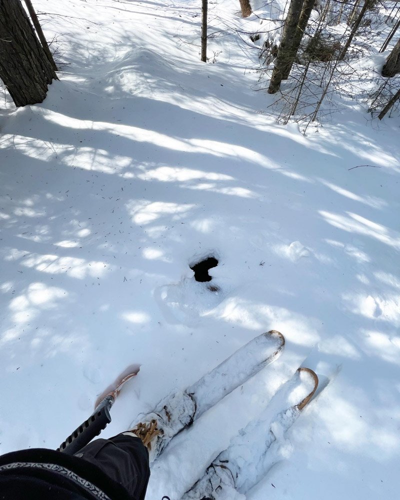
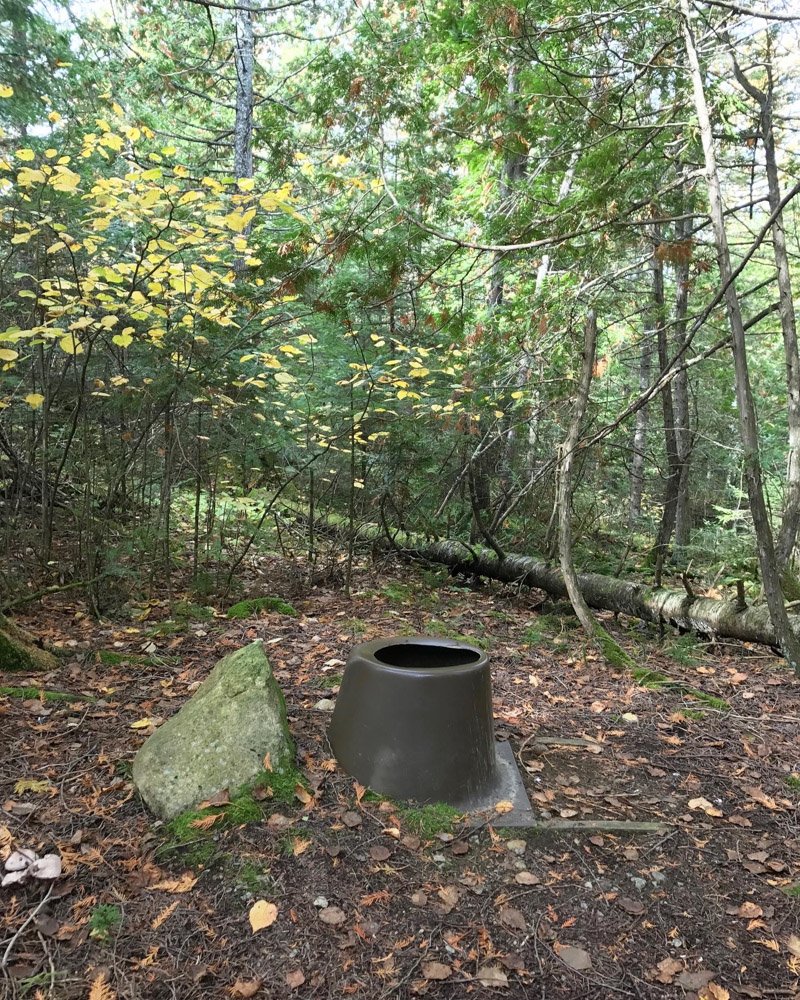
The Hidden Latrine
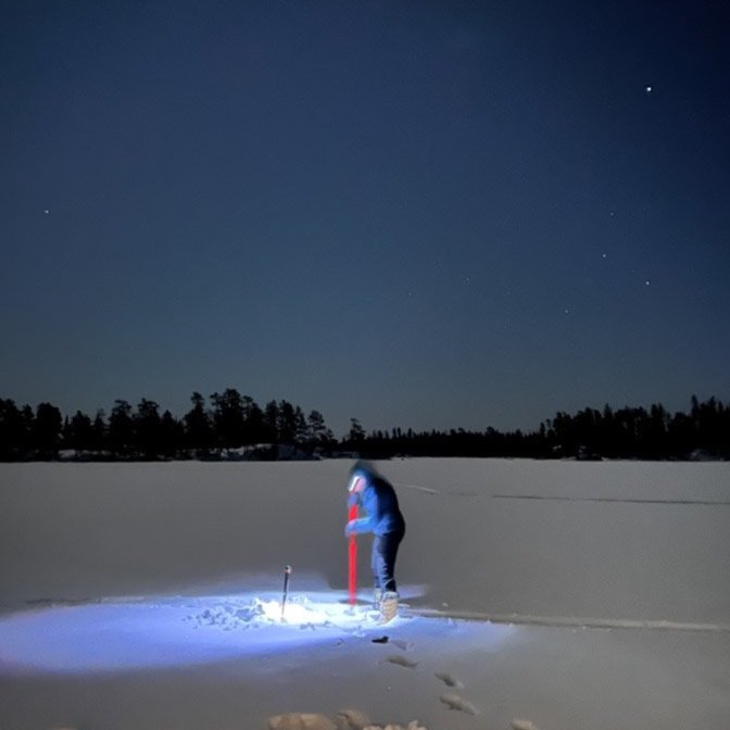
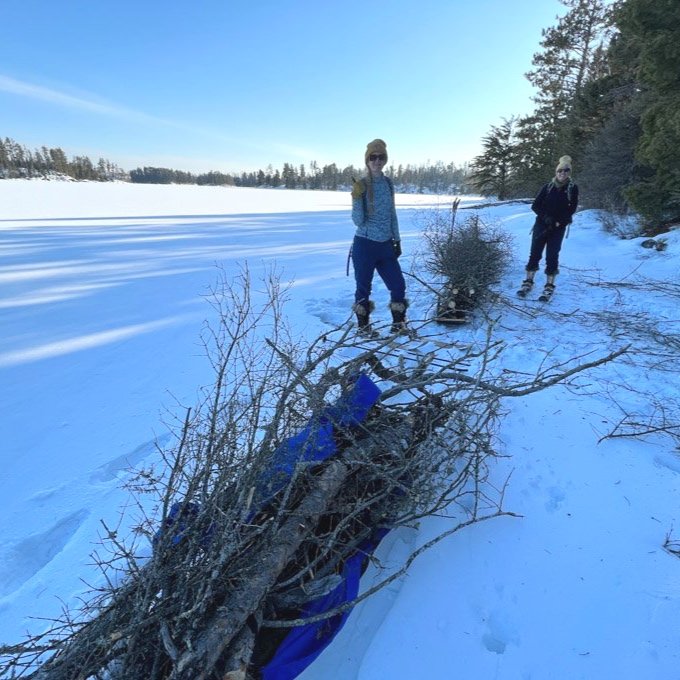
While the group rested on the ice, I decided to confirm my suspicion and locate the latrine. Every campsite in the BWCA has a firegrate and a latrine. There are no other identifiable markers or signs. I kept on my skis and headed up the steep, scrappy hill to what I figured was the main area due to it being more open, with few trees. I saw an “opening” in the woods that could be the latrine. But being buried in snow, it was hard to tell. I decided to follow it as it made the most logical sense, heading away from any water source. I came to the top of a hill and explored it a little. All but three size fell off into a short cliff. I looked back into the woods and pondered a way. There were more woods that I could push into where the hill wasn’t as high. Maybe that was it? For an area that gets a lot of use in the summer, it didn’t look much like a trail anymore. I decided that I’d continue inward for another ten or so minutes. If I couldn’t locate the latrine, well, then I’d figure something out.
A few minutes later, I was skiing through balsam and birch when out of the corner of my eye I saw a small hole. Initially, I blew it off as an animal hole. But then my mind said, “wait, is it?”. I bent down to the ground and brushed it off. Lo and behold, I saw the telltale sign of the brown molded top that indicated it was the latrine. It was buried at least three feet beneath me. No way! I couldn’t believe it. I grabbed the shovel I was carrying and started to scoop up snow, revealing the “bucket with the hole”. When the others saw it, they were shocked that I ever found it. I was too.
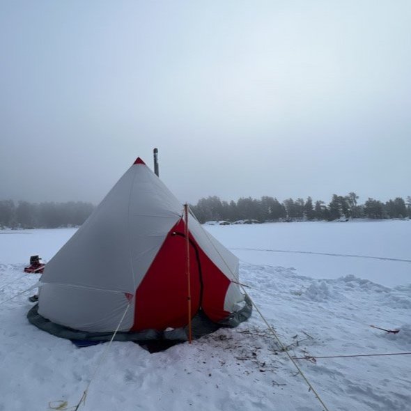
Camping on the Ice
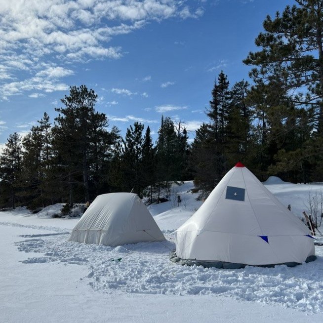
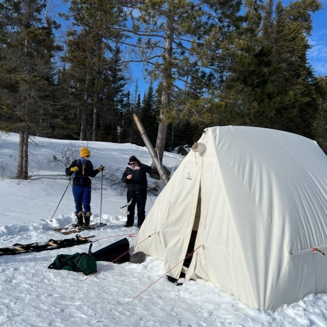
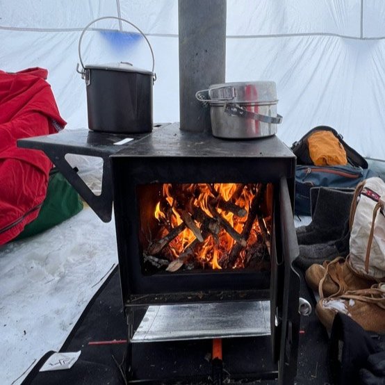
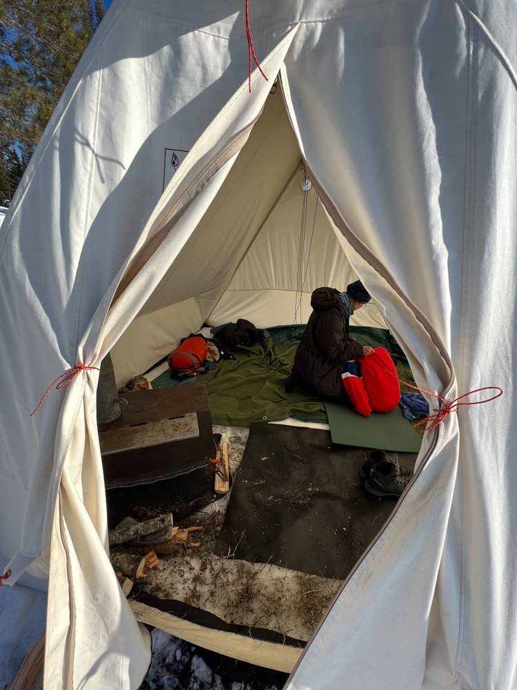
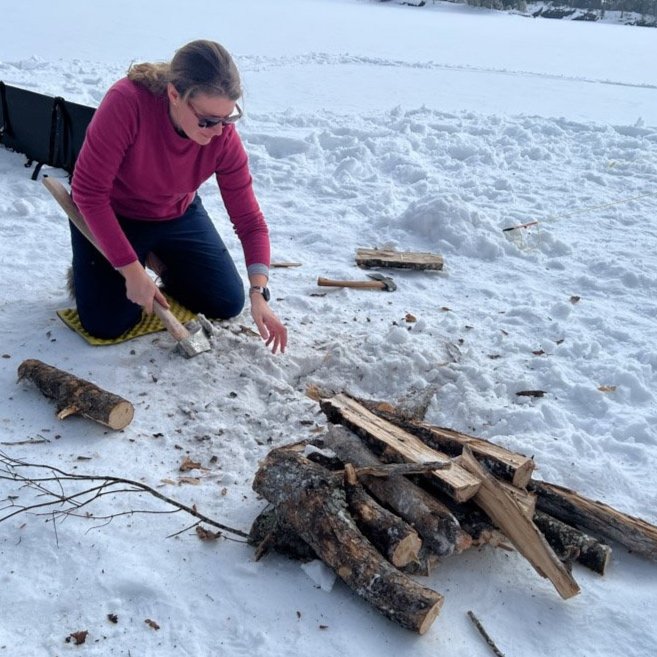
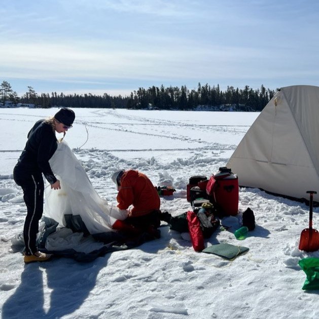
We spent the rest of the afternoon setting up camp on the ice. Two tents were set up facing into the southerly breeze. It was all hands on deck as it took time to hold onto the framework while the tent was draped over it. A few people got busy pounding the ice stakes, making sure the tent would be stable. A second tent was set up for extra sleeping space, but it became the primary cooking and eating tent. Made out of parachute material, it blew like a kit in the gusts, and it took most of us to hold it down while we secured it. Small wood stoves were placed in both tents. While a few set up the kitchen, others took the toboggans and went in search of wood. We found a good “wood lot” about a quarter mile from camp that had spruce and other deadfall. We filled up all three toboggans, as I prefer to gather most of our wood needed for the duration of the trip right away. Knowing two stoves would use quite a bit, I was glad the sleds weren’t heavier to pull. Back at camp everyone worked to saw the wood into stove length and organize it into groups of tinder, kindling, small, medium and large logs. We’d split stuff later, as I needed to start a dinner of sausage and veggie gumbo.
As the evening wore down, it was clear that everyone was tired. The first day is always a big adjustment physically and mentally. I always tell my my groups during our orientation that the first day can feel a bit disorienting; and that it is normal. But I also tell them that by the end of the trip, everyone is a well-oiled machine and works as a team.
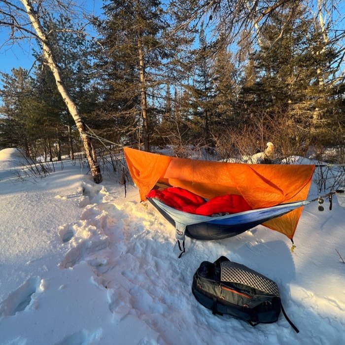
I had meant to put up my hammock to sleep in; something I do on most winter trips that I guide, but I was wiped. Trips are kinda non-stop for me, and this day was especially so. So, I joined two others on the tarp on the ice. Snuggled down into my bags and slept, abet fitfully. But even with the wakefulness, the moon and stars were incredible, and I felt truly lucky to be on this quiet lake, deep into the wilderness.
Gravy Day
The light hit my eyes in the morning as the sun began to crest over the far shore. I checked my watch and it was 7:00. Nobody stirred so I waited until 7:30 before creeping into the tent and starting the fire. I think it’s a treat to wake up to a warm stove crackling and popping and the others enjoy it too. After, I got busy lighting up cook stove, setting water to boil while rehydrating scrambled eggs and hashbrowns. There is a huge satisfaction I feel having camp set up so that everything runs smoothly. I relish in the quiet as well. Once the others begin to stir, I bring over the coffee and tea. Because we worked hard yesterday, today is a gravy day; a day to relax and explore. Some chose will continue, like gathering and boiling water, but I hope to have a good chunk of time after lunch to take a group on a day trip.
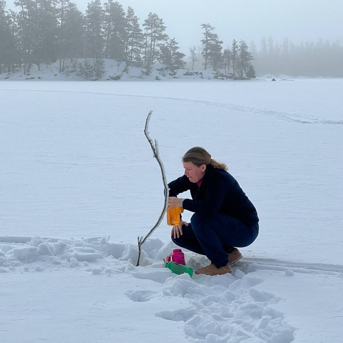
Once breakfast is over and dishes are washed, we spend about an hour splitting and processing wood. I gather and boil more water, which sometimes feels never ending. Ha! But it’s so important that the six of us stay hydrated, especially being so active. Mid-morning, I grab my hammock and set it up back on top of the hill where the actual campsite is. My hope is that I’ll be a little warmer and sleep better. Everyone enjoys some downtime, resting, reading or wandering around the bay.
At lunch, I fire up the camp stoves again and make gourmet grilled cheese sandwiches using multiple kinds of cheese. Ladle’s of tomato and basil soup are poured into metal mugs. The tent is warm as the sun is fully overhead with a soft breeze and temps warming to 35º. I need to remember to put on sun block when we head out.
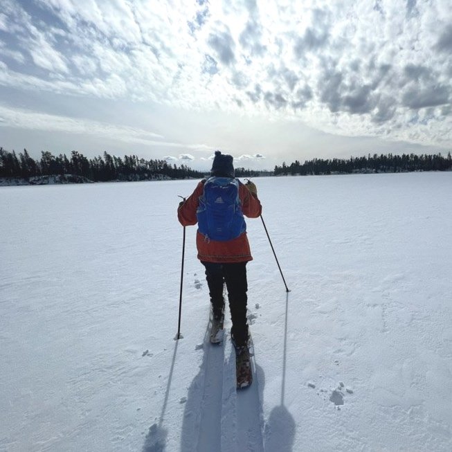
Around 1pm, a group of us straps on skis. I’ve made plans to take them down into the Pagami Creek drainage, a small, but scenic creek not accessible in the summer. One person opts to stay back and relax, and with the sunshine beaming, it will prove restorative. In my guide pack, I gather some emergency gear, extra snacks, first aid, water, extra gloves and a group sitting pad. Tucked into my waist belt is a waterproof topographic map and, around my neck, my compass. Navigation in the BWCA is primarily by map and compass. For good measure, I take a bearing, but can see from where the arm standing the bay to the south that will take us into the creek area.
We glide forward with the ease of not dragging sleds. Beneath our skis, tracks of fox, deer and the occasional hare dot the ice. But the animals are quiet, and I suspect tucked back well into the woods or deep under the snow.
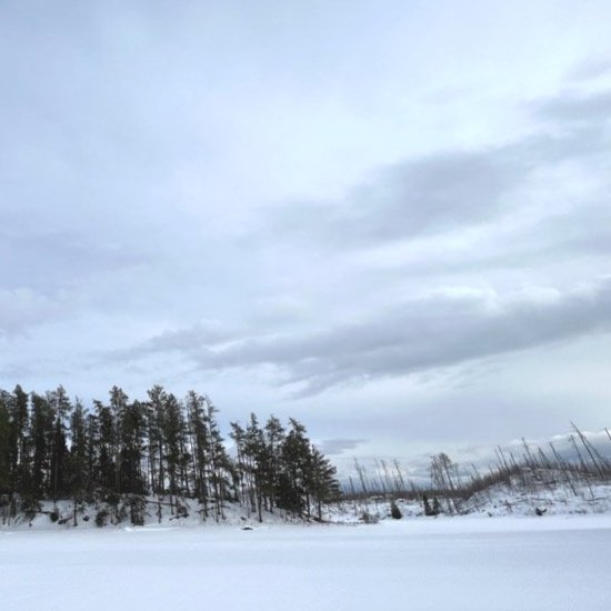
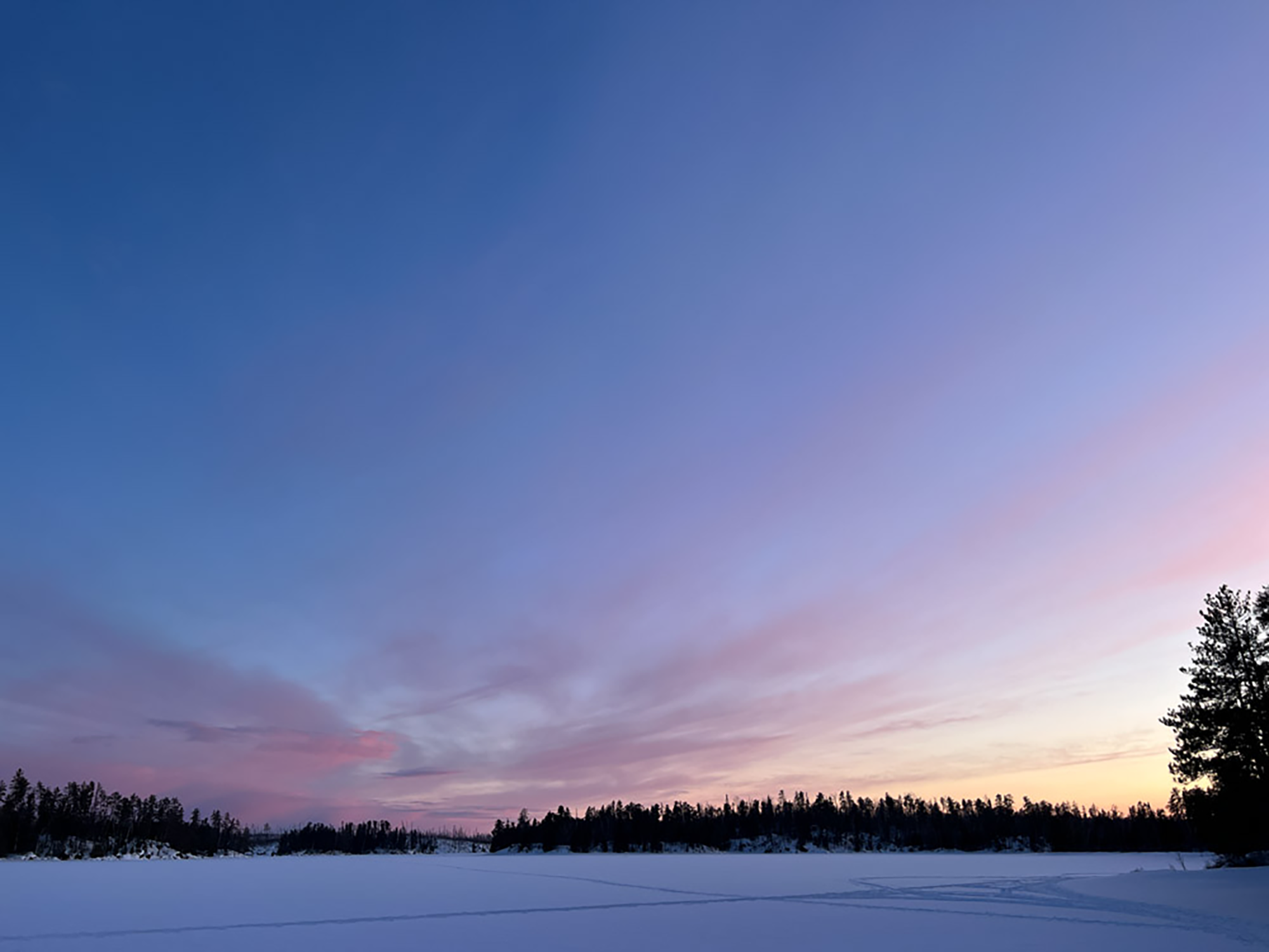
Looking south towards the Pagami Creek drainage. Lake One.
Wildfire Impack
The Numbered Lakes' region is an area in flux. In 2011, the Pagami Creek fire started from a lightning strike, burning over 92,000 acres. One of the larger wildfires in history. As you explore the region, there is a clear line of landscape where the fire burned and where it did not. To the south, it’s very evident, especially in the winter, with stands of dead and burnt trees dominating the landscape. It’s easy to read the geography. The islands in the lake and the landscape to the north were untouched, and the distance between the two is only about a mile apart.
We ski pass some of the numerous islands in the lake, all filled with towering white and red pines, perched even higher on large slabs of Canadian shield. The gray, granite rocks are imposing and beautiful. They are a nod to a strong landscape that has stood the test of time.
As we get closer to the channel of the creek, to the southeast is are mostly barren hills and to the west, miles of forest. We ski over bog and creek and it’s mostly impossible to know which we’re on. Sometimes the ground has a little more give and I figure we must be on the bog. After about an hour, we stop near a cluster of good sitting rocks. Peering south, we can see more of the main channel, but it has many pockets of open water due to the active beaver population. Everyone sits and enjoys a snack and a break while I go and inspect a dam that has been engineered over the creek. There is another maybe 60 feet upstream. Due to the open water, we won’t go further.
After the break, we head back north, taking another route to see a little more of the lake. Clad in a t-shirt, I’ve spent the afternoon comfortably warm. But with the warmth comes tacky snow. As a result, we pause numerous times to knock it off the bottom skins of our skis. It’s persistent stuff.
About an hour later, we’re back at camp. I pause to change my clothes before heading into the cook tent to start dinner. Veggie burgers are on the menu. The recipe created by the outfitter is one of my favorite meals. We top toasted brioche buns with pickles, sprouts and mayo. Flavorful and filling! Bags of assorted chocolate are pulled out and passed around.
Water is heated yet again for dishes and evening beverages. Later we’ll heat more water to pour into Nalgene bottles. Those will be firmly sealed and tossed into our sleeping bags so that when we crawl in, they’re cozy and warm.
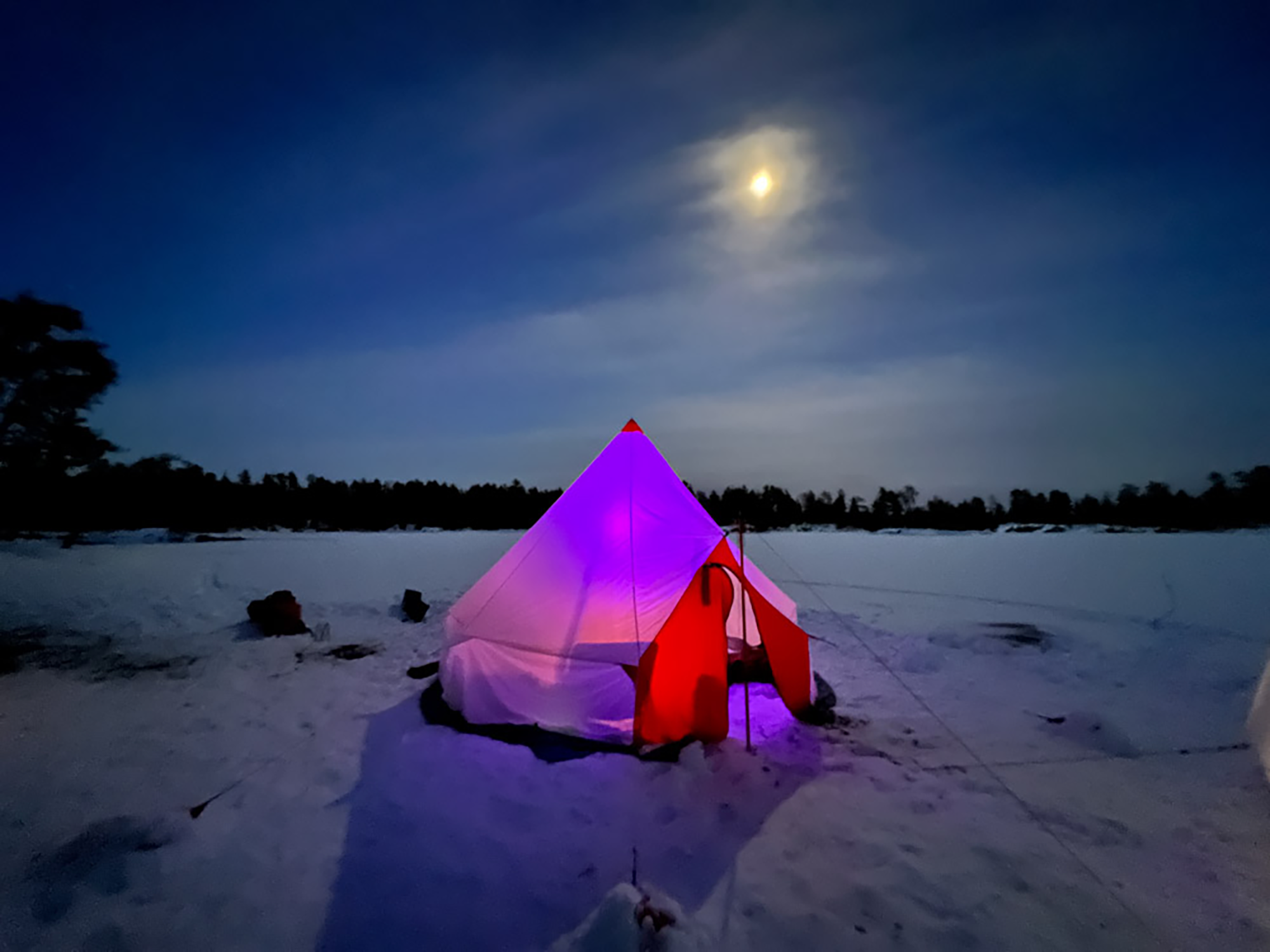
Ultralight nylon tent designed by Cooke Custom Sewing. Aka “the circus tent”.
The Dark Sky
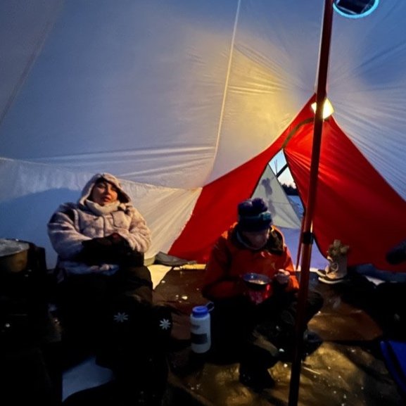
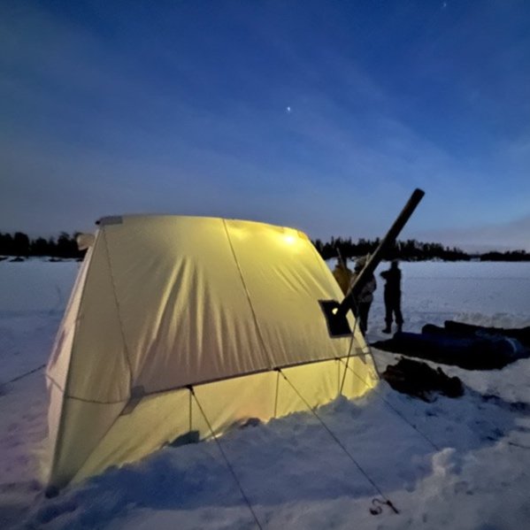
The night sky kicks off with Jupiter and Saturn rising as bright lights to the southwest. While the lemony sky fades to the east, deep, dark blue begins to fill the space as pinpoints of light began to appear. A few walk way out into the middle of the lake, encompassed by the brilliance above them. We feel insignificant as we’re enveloped by night. The moon rises, casting bright light again. I turn on the colored, solar light in the cook tent, which now seems to beg for a dance party. The canvas tent is illuminated by two lanterns, giving it a soft, golden glow.
Most of us hang outside, enjoying the relative warmth of the winter evening, enjoying the moonrise. I light a candle lantern, adding to the ambience, and smile at the conversations floating over the ice. Surrounded by so much beauty fills me with gratitude and gratefulness for this special place.
It’s just us here, miles from others and town. For a brief while, we are given the opportunity to unplug. To recall what really matters. Everyone bonds as a team and have move forward from strangers to friends. It’s an amazing thing to witness, as we delight in being human.
We try to stay up past nine, but eyelids heavy, each person eventually drifts off to go to sleep. Four under the stars, two in the tent by the fire. Tomorrow, another warm and bright day will dawn. I will get up and stoke the stove, preparing a hot cereal of steel cut oats, mixed, dried fruit topped with maple syrup and brown sugar. Everyone will pitch in to take down camp and the little evidence that we were there, will disappear with springtime. I will have one last, long glance at our site, attempting to capture all the memories inside, as I lead the group forward, toboggans once again following behind.
RESOURCES
Google map of our route that includes points of interest and our day trip.
A great Ely outfitter if you’re looking for guided trips; specializing in women-specific adventures. Full disclosure, this is the outfitter I guide for.
Black river sleds make great toboggans of all lengths.
Our recommendation for backcountry skis for winter camping. They fit most winter boots.
Want to plan your own winter camping trip? Check out our handy guide that tells you how to begin. You will need to grab a permit at one of the entry point, trailhead kiosks or at the nearby ranger station.
Plan on fishing? Pick up a fishing license through the MN DNR.
Looking east. Lake One.
Disclaimer: I do not receive any compensation from the resources mentioned in this article. If you want to go on your own winter camping trip, it’s up to you to plan and prepare for all the conditions you may encounter. Honestly assess your experiences, fitness and skill set. The BWCA is a remote wilderness area and help may be hours or a day away. Conditions change frequently. Check with local outfitters and ranger stations for current updates. Information stated in this article may be inaccurate or not up to date.