

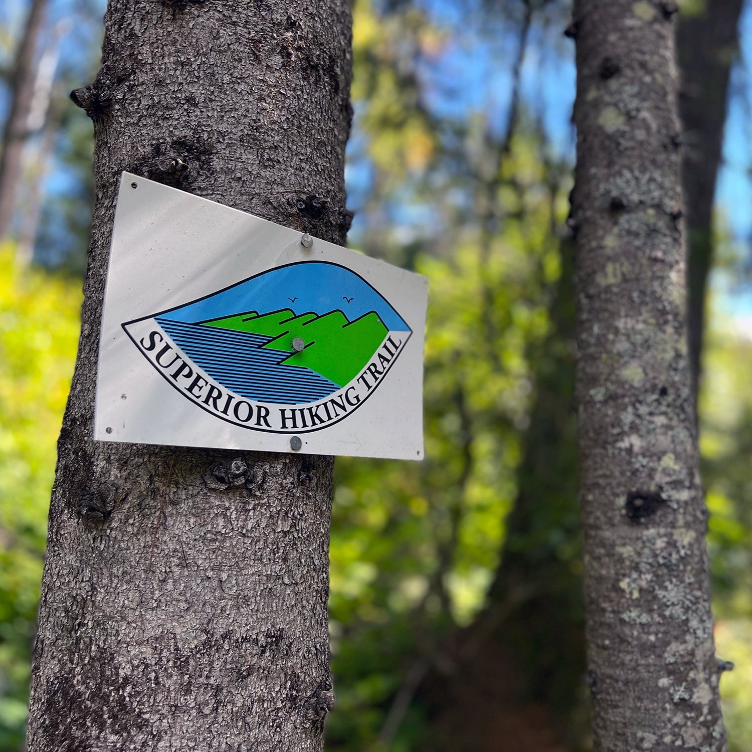
Superior Hiking Trail Thru-hike | The Middle
Read the beginning of this journey here.
“No need to be barbarians”, the trail angel quipped as we picked up our resupply of food and other sundries at his place. A little earlier that morning we’d paused at his pottery shop, located along the trail. We’d asked if he encountered other hikers much, knowing the trail goes near his property. He commented, “Now men…you can smell them thirty feet away. I’m not sure how often they bathe. But women, they’re neat and pretty clean”. Alright then, we’d now had a new motto to aspire to. No need to be barbarians on this journey.

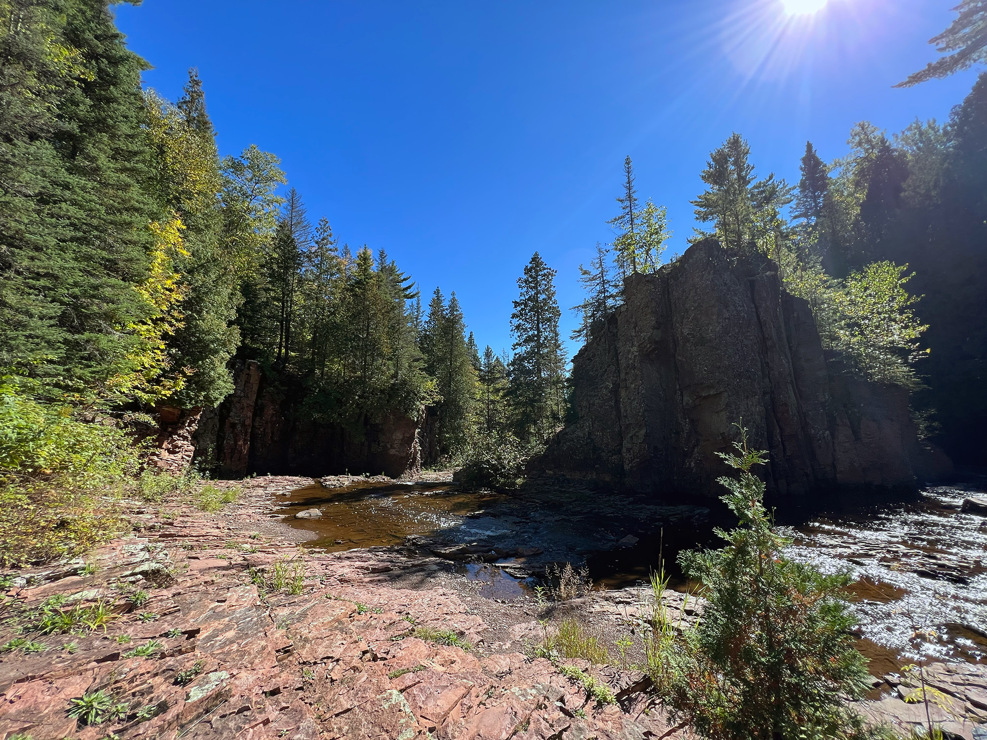
Sawmill Dome vista.
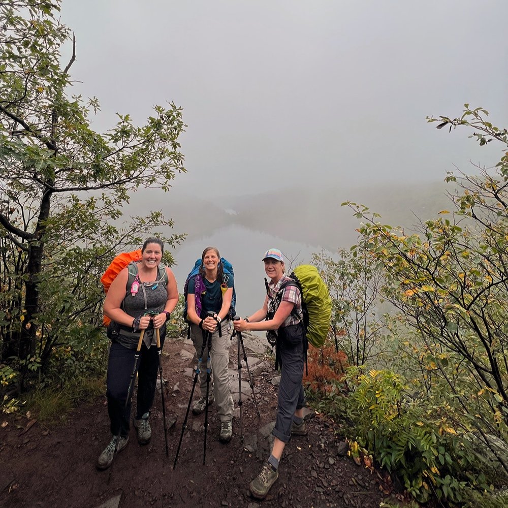
Finally, some other Thru-hikers!
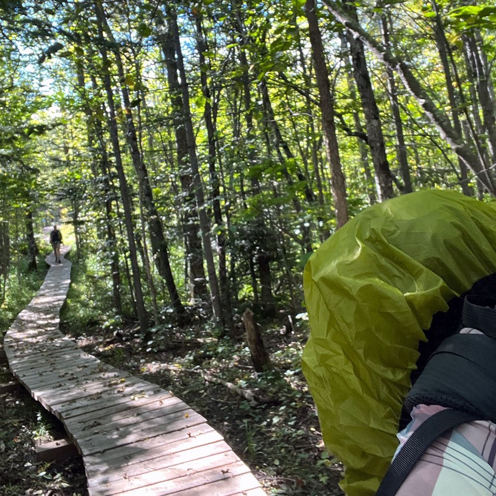
We were well north of Duluth and in the thick of it. We’d only seen a handful of other hikers, some doing a section of the trail, others doing a traditional thru (260 miles) or a full thru (310 miles). Give or take of course, ha! After six days, our new trail friends, Texas and Stumbles were the first northbound thru hikers we’d met. It surprised me how quiet the trail was. I expected to encounter more hikers knowing early fall can be fantastic as the temperatures are usually mild, bugs are gone and fall foliage is brilliant.
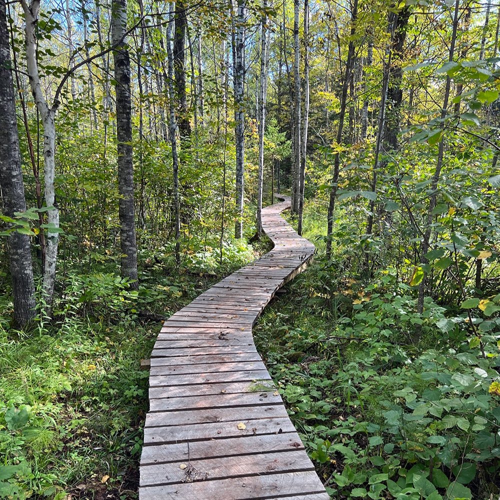
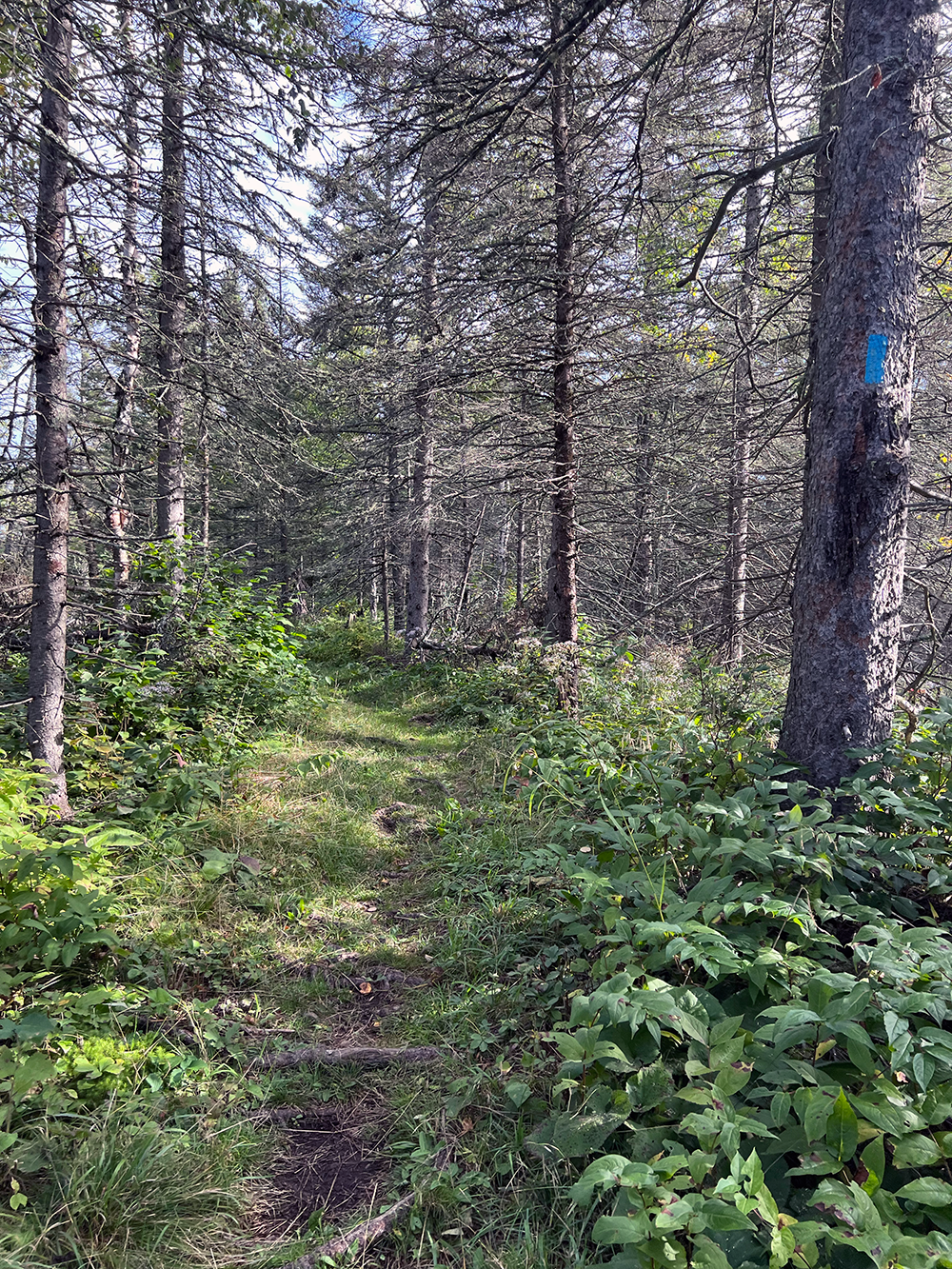
It was time to get cracking and temps were expected to be nearly 80º. The air was still. Wishing our northbound friends well, we left Big Bend campsite at 8am, our standard departure. Hopefully we’d see them again as there were many days and plenty of trail left. The day was fairly uneventful but warm, nearing the 80º’s. We walked on easy trail. Dry and mostly packed with a few muddy spots. Gentle hills wove through managed clear cuts, some from twenty years ago. It was a study in forestry with trees in varied stages of regrowth.
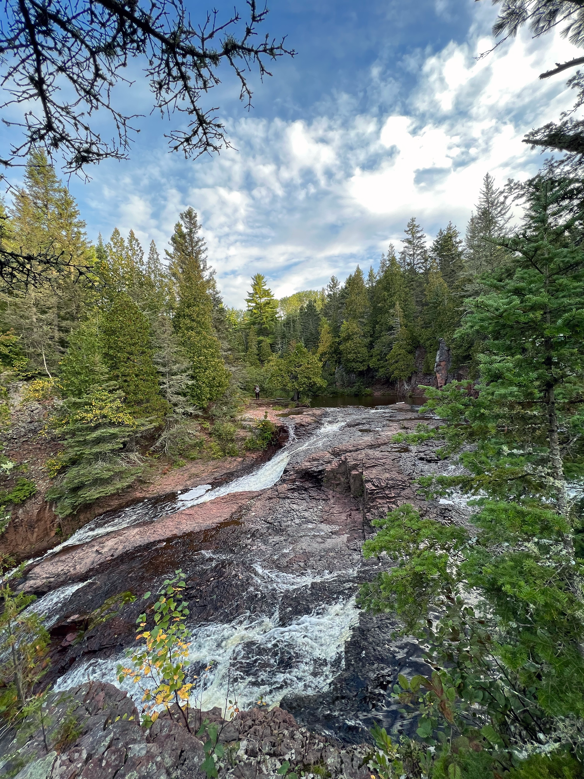
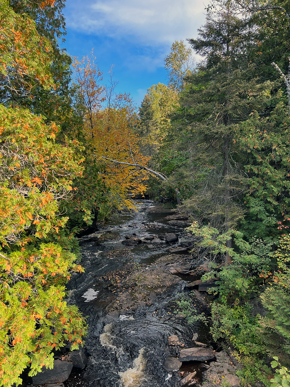
We ran into a few other thru-hikers. I can only recall “Monarch” and “Pacer”, both women hiking solo. Otherwise it was quiet. We really haven’t seen much wildlife other than squirrels and birds. I ate my usual lunch of salmon packet, mayo, meat stick and some trail mix. Sixteen miles later, we heard the cascade of Reeves Falls, signaling that we were close to our next campsite. We had it to ourselves and enjoyed an early evening dip in the cool pool below the cascade.

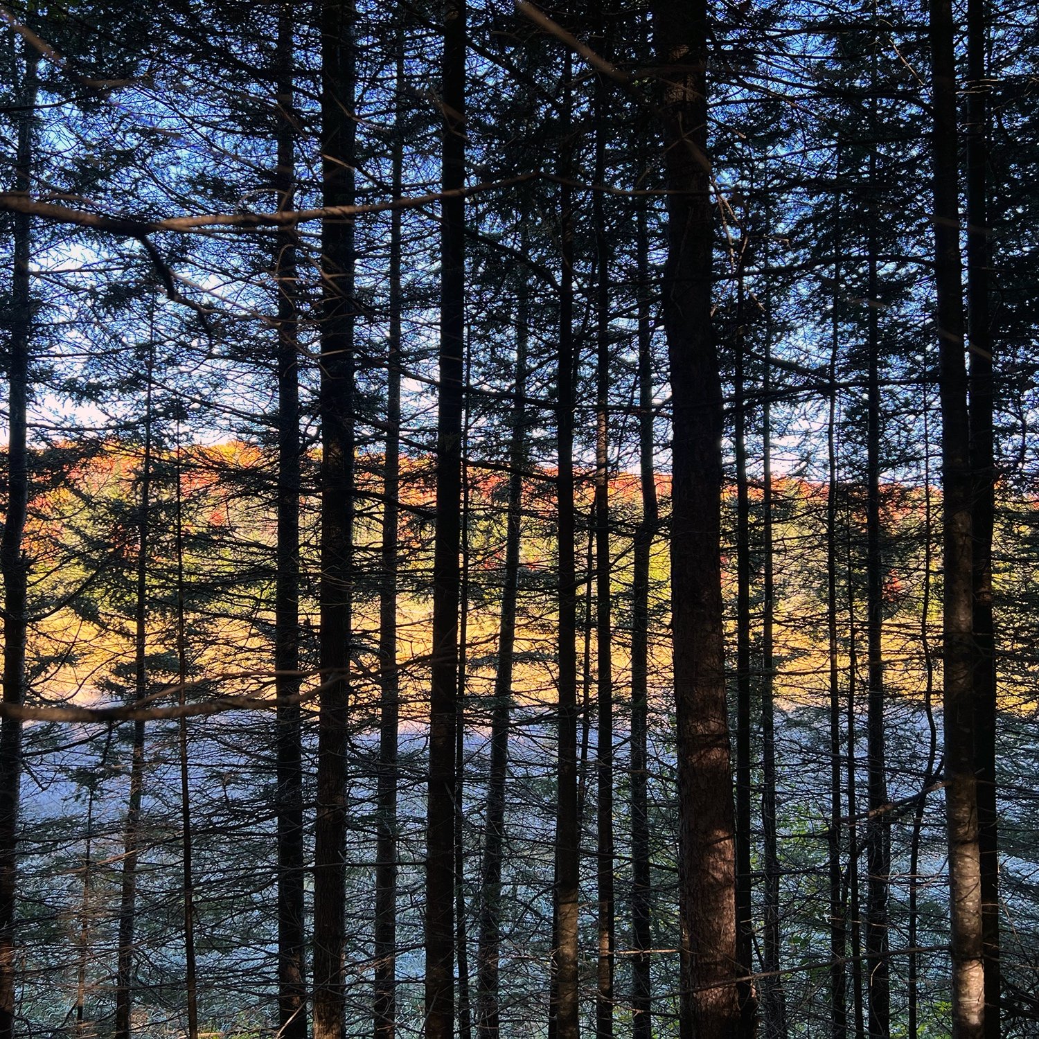
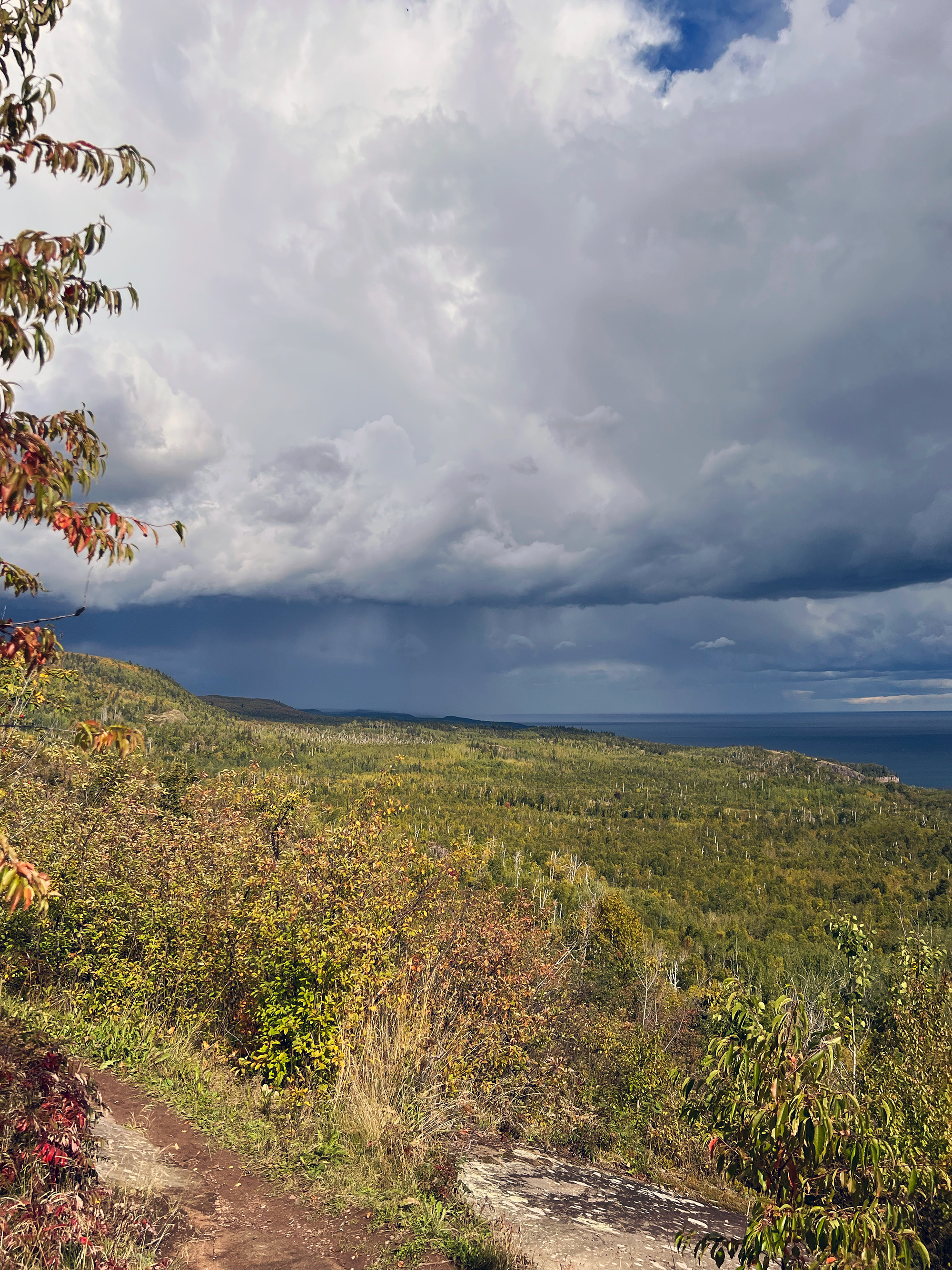
Lake Superior, the largest freshwater lake in the world at 32,000 square miles. View from Wolf Rock.
Peaks and Valleys
The following day, there was a three mile reroute that began at Lake County 2 (northbound), but it was well marked and we had not problem figuring out the route. Occasionally private land owners revoke trail easements through their properties for a variety of reasons, the biggest being disrespectful trail users. There are many spur trails along the SHT, so the trail is used by many people, some just out for the day. Oh and we hit 100 miles! After picking up our resupply at the potters place, we finished the road walk, stopping to celebrate (time to dance!) and enjoy the milestone.
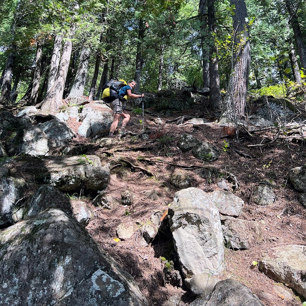
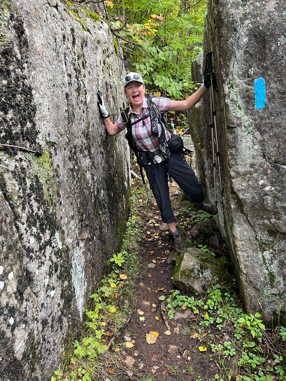
I woke up the next morning looking forward to this next big section.. It was very familiar territory as I’ve run a few ultra’s on the trail. Overnight temps had been comfortable, somewhere in the mid-50º’s. Perfect sleeping weather I think. But the trail was muddier and it was a balancing act in places as we hopped along wet rocks and down branches. At some point I decided that my feet would just be muddy and wet. No big deal. Spending a lot of time mostly tucked into the woods, we hit a beautiful overlook, Wolf Rock. Scrambling through boulders to the top, we were rewarded with views of Lake Superior to the southeast. The water danced with sunshine beyond the undulating hills to the shore. Later we were greeted by a porcupine, ambling along the trail
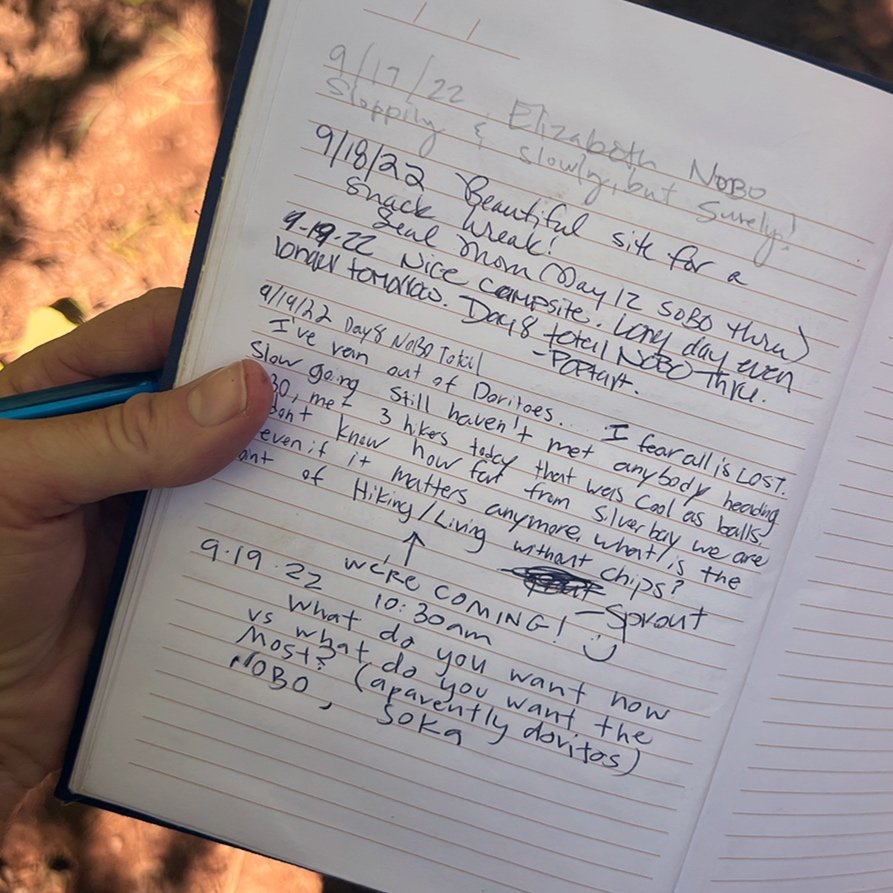
A few miles later, I came into the East Gooseberry campsite with one less camp shoe. Somewhere along the way it fell out of my exterior pocket. But the trail provides! As I walked into camp, sitting on the bench near the fire grate were some flip-flops. It was doubly awesome that they were in my size. The site was situated along the lazy flow of the Gooseberry river. Mudflap walked down to filter some water and ran into another pair of NOBO hikers that we’d seen in the register, Poptart and Sprout. Following them more closely for the past few days, we were excited to meet them. We hung out at their campsite for a bit and learned they’d attempted the SHT last year, getting taken off by forest fire closures.
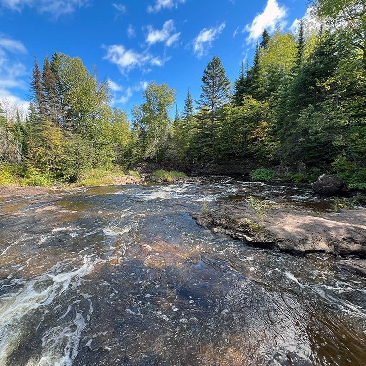
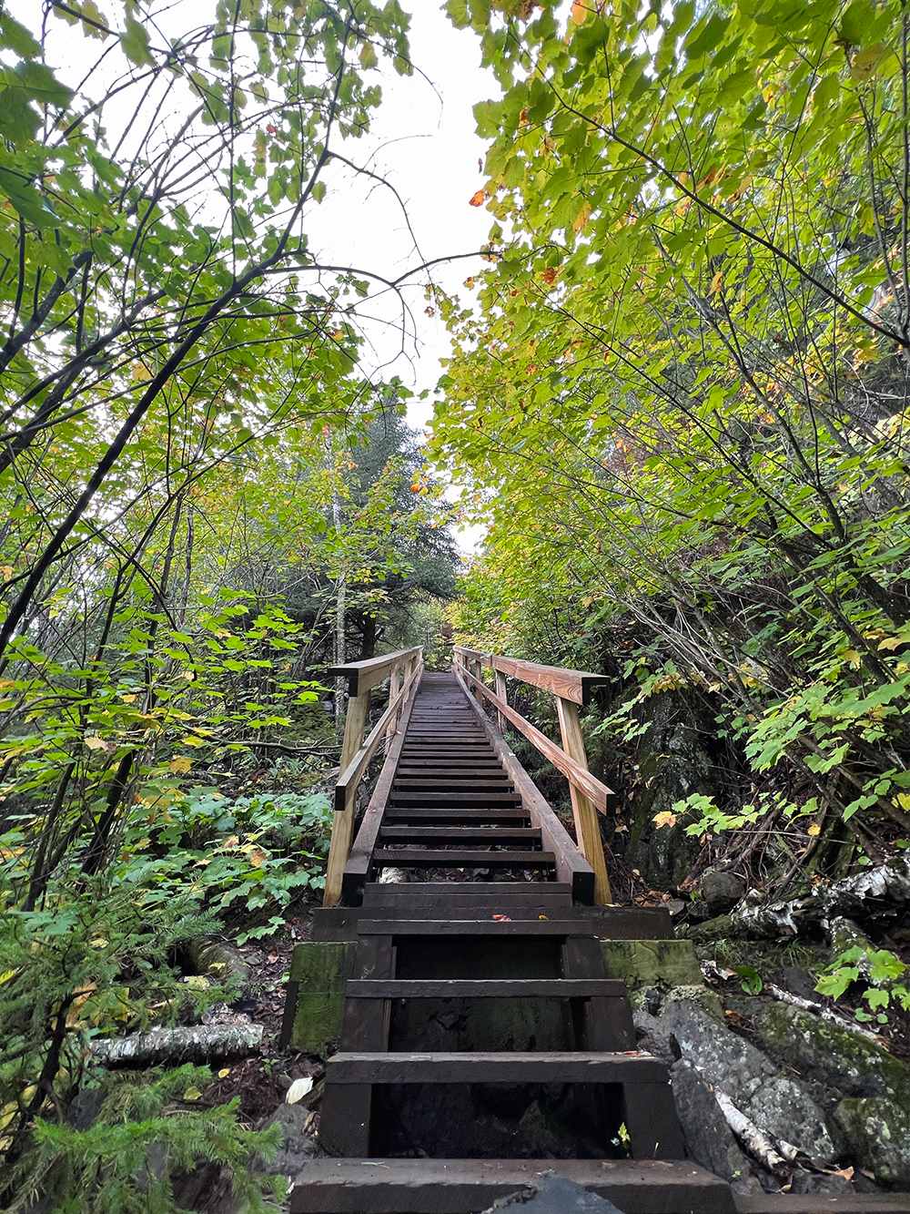
We were beginning to hit some more awe-inducing sections of the SHT, including places we’d encounter many day hikers. Nearly every day we passed a cascade or waterfall as the trail often dropped down into gorges or canyons, following cascades and rivers before crossing them. The trail often climbs and climbs only to descend soon after.
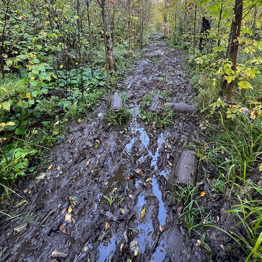
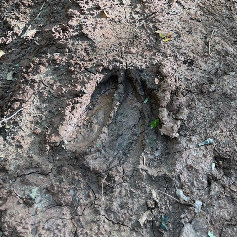
The next morning took us through the Gooseberry reroute. A few newly constructed miles of trail that we’d heard mixed reviews on. Most hikers were telling us the sections of clay were awful but the boardwalks were great. Notes in registers reaffirmed it. We decided to try to get on the trail a little earlier as the night had been cooler and we hadn’t had rain for a number of days. The trail was awesome and clearly the key is to hike it in cooler conditions-anything else might be a bit rough. It was gentle and we moved along quickly noting a moose had used a good portion of it was well.
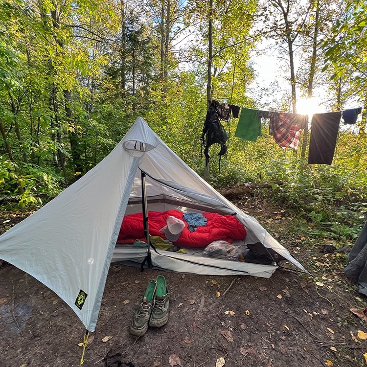
Hiking eight miles that day thanks to numerous high mileage days, we arrived to Southeast Split Rock campsite. A total gem that we had to ourselves. Our site was tucked in the gorge of red rock where the cliffs split, hence origin for the name of the river. We had front row views of two cascades and our tents nestled under the shade birch and pine. I bathed, took a nice long nap and dried out clothes.
The next day I woke up cold. Trying to pack quickly, I got up shivering and paced until my partner was ready. The downside of being in the gorge! Knowing the sun wouldn’t hit us for a while, we moved quickly out of camp, practically running uphill to Bread Loaf ridge and the warmth of sunshine. Freighters in the distance looked still, slowly pushing their long bows of cargo moving towards other great lakes to the east.

Breadloaf Ridge.
Split Rock River.
Uppity, up, up, up.
I shouldn’t have looked at the elevation chart in the data book that I was carrying. The trail trended uphill all day. For nearly sixteen miles. Granted this isn’t the mountains, but there are some big hills here and plenty of PUD’s (pointless ups and downs).
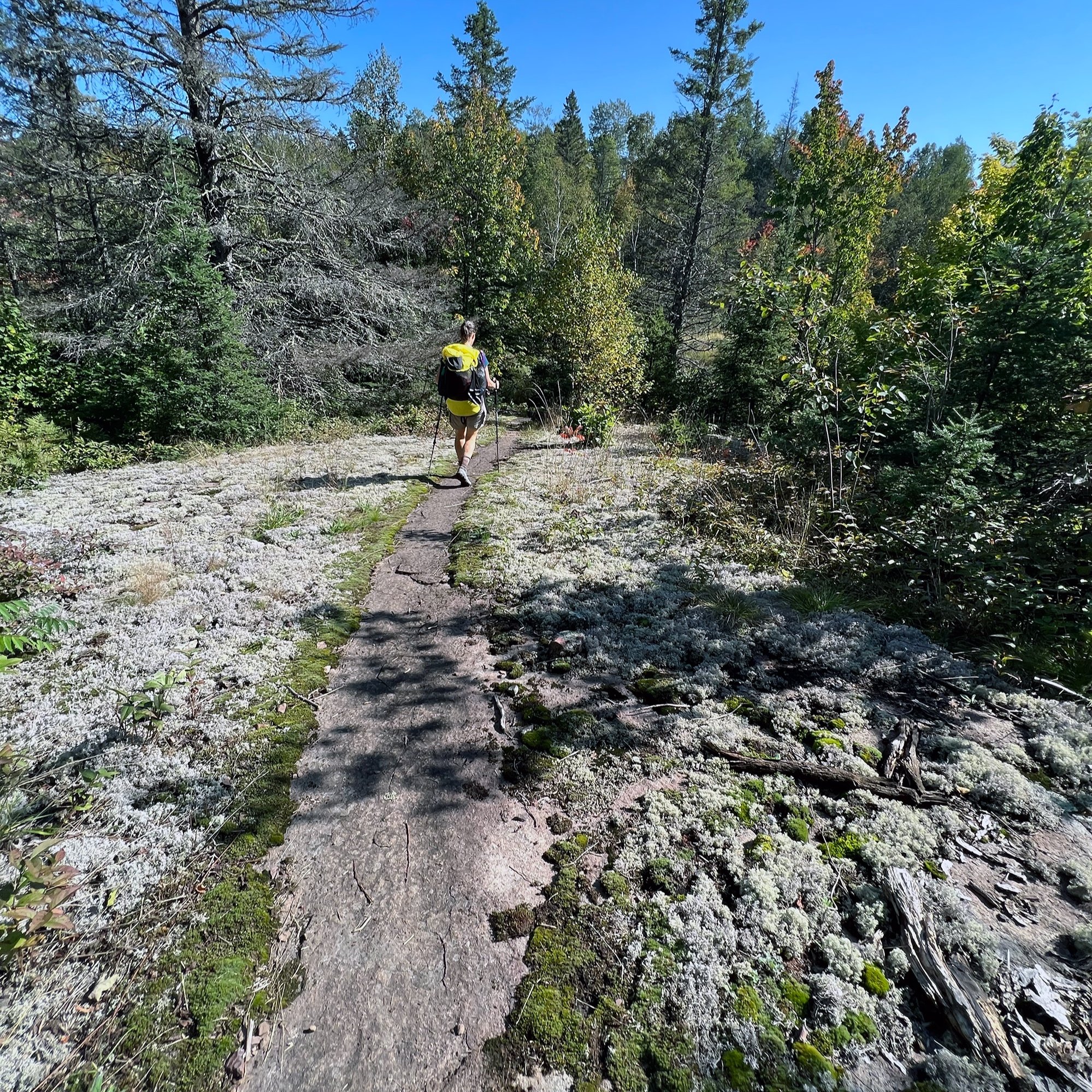
The payoff is dozens of dramatic views along peaks and ridgelines. We were in awe as the trail threaded between blankets of silvery-green reindeer moss and bright red lichens. Along ridgelines, we’d peer into valleys below, searching the scattered bogs for moose.
We’d planned on staying at one of the Beaver River campsites, roughly three miles from Silver Bay. Looking at the forecast which called for cold and persistent rain, we decided to push the final three miles into the town. Once in town, we headed to a motel, enjoying showers and laundry. Hello hot bubbling pizza! Our friend Carrie had driven up to Silver Bay to hike with us for a couple of days so she brought some of our resupply and was kind enough to drive us around for various errands.
The following day, we got past what would be the busiest section of the entire trail, Bean and Bear Lakes. While it’s great to see so many folks exploring this iconic overlook, the trail is loved to death in this section. We were grateful to get past the congestion and noise. I’d done this section a few times so I wasn’t crushed that the views were socked in with fog.
Finally the clouds began to break. A rainbow punctuated the sky as we stood on the bald overlook on Mt. Trudee. The world was flush with autumn color and the last vestiges of fog threaded through the valleys. How could a day be more perfect I thought as I munched on a handful of chocolate covered potato chips; a gift my family had sent north. Later we took a four mile reroute through Tettegouche State Park. The signage wasn’t very clear so I called the park office quick for confirmation of directions. Hikers are notorious for not wanting to hike any more “off trail” miles than they need to. Needless, we ran into others confused by the lack of signage as well.
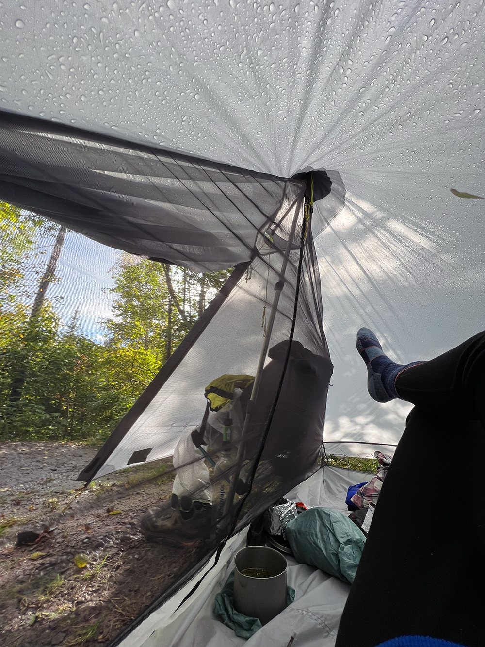
But the north is finicky and the weather can change quite dramatically. The end of the day saw us running down a ridgeline as we watched dark and moody storm clouds moving in from the north. Thunder rumbled and lightning began to flash. A half-mile later we scurried into Kennedy Creek campsite and threw up Mudflaps tarp just as the first of the raindrops fell. I checked the weather. Hail, rain, cloud to ground lightning and 40mph winds were expected. Minutes later hail started to fall and thunder echoed off the hills.. Thankfully the hail was small, but the wind blew. During a lull, I popped up my tent on some high ground, snugging up guylines and double checking the door. As I sat inside while pops of thunder echoed off the hills. As the sun set, the storm quieted. We were dry, relieved and warm.
Forecast called for 0% of rain. Check the weather but pay attention to the sky. We heard rumbling but couldn’t see the front until we came around a corner. We ran the last half-mile to camp.
Another Milestone.
We experience so much over the course of each day. I’ve noticed that my senses are heightened. I guess walking for eight or more hours a day does that. I can smell the musky scent of an animal that has recently crossed the path. The ponds smell sulfury and are blanketed with rotting wood. Changes in temperature and humidity are obvious. If my pack is imbalanced a little, I notice it. My taste buds prefer salt and savory. Life is simplified to the full immersion of our surroundings and I’m liking the shift.
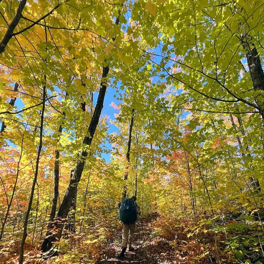
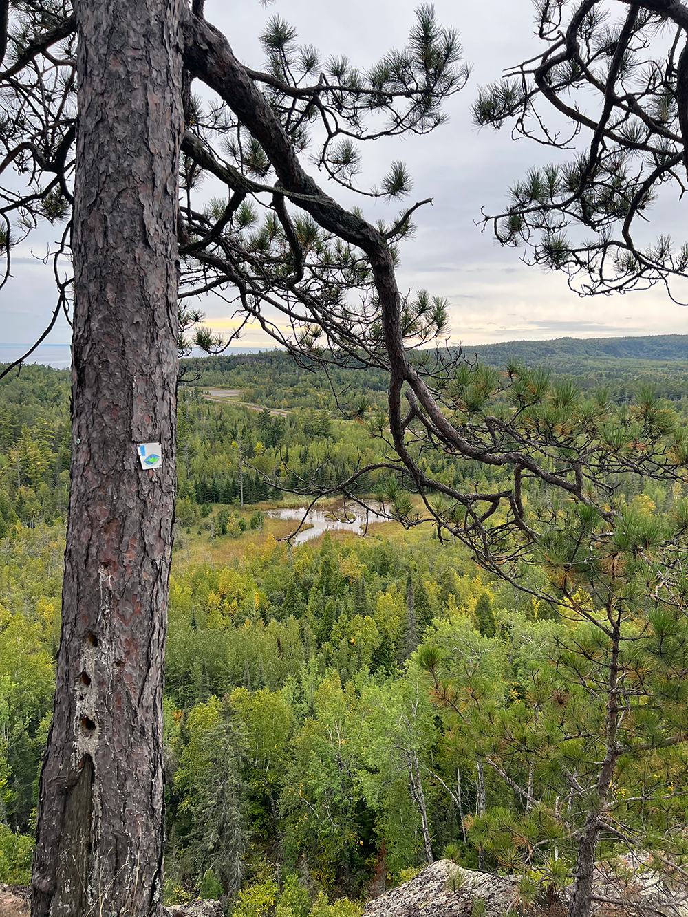
Section 13. What a bland, nondescript name for an incredible area. I felt exhilarated as the wind blew over the exposed rock, a few scrappy cedars clinging inside cracks. Peak color was not far away and the hillsides were dappled with the shade and sunshine of fast moving clouds. For as far as they eye can see, forest upon forest. We are deep within the Superior National Forest which blankets most of northeastern Minnesota.
Later, as if trying to outdo the morning brilliance, we walked out onto Lily’s Island, to watch a candy-coated sunset, the sky brilliant with lavender, peach and pink. My tent was safely tucked back at Sonju Lake campsite, and a small tippy board walk had taken us out to the only accessible island on the trail. It was a miniature version of the boreal forest; scrappy white spruce and pockets of wintergreen and sumac clung to the slabs of the Canadian shield. Wolves called and sang, bringing to close a nearly perfect day.
Near Horseshoe ridge the following afternoon, I sing happy birthday in Swedish another hiker. She and her friend are out day-hiking. We’d just come out of what I feel is one of the most challenging bits of trail, the Manitou River gorge. The descent down is scrappy and a bit scary. I’m grateful for trekking poles. There were spots where I used my hands to scramble up over and around car sized boulders. The women immediately identified us as thru-hikers. Hmm…maybe the smell? They offer us fresh apples and caramels and mentioned the birthday, hence the singing.
I’ve been on trail so long that I now smell like an onion. I shudder to think that others can smell me, but my hiking partner and I swear we can’t smell each other. Ha! Right. So as I put on my semi-frozen clothes the next morning I notice the rinse I gave my shirt the night before didn’t help much. Ah, Dyers Creek, you’re nice but I won’t miss you. The nights are getting colder and sitting around 30º. Frost reflects off my sleeping quilt and as I sit up, crystals fall from the ceiling of my tent. I haven’t been sleeping well for most of the hike and I’m not sure why. Each night I head into my tent, usually around 7pm and then I read for a little while, easily falling asleep for a few hours only to wake and sleep fitfully for the rest of the night. It’s a bummer as I so look forward to each day.
The following afternoon we’re dancing in front of hikers parading up and down along the Temperance River trail. We’ve hit 200 miles! In a couple of days we’ll hit the ski resort of Lutsen. It’s still hard to imagine that we began hiking fifteen days earlier at the southern terminus. With only a couple of days left of food our packs are light. That evening we’re settled at the Onion River campsite, bathed in the last rays of sun coming through the pines. It’s quiet, the creek moves along in hushed tones below. Mashed potatoes with bacon and veggies fill my mug. Falling asleep, a Barred owl calls. They call most nights, sometimes to each other. This feels like home and I am comfortable with the simplicity of the repetitive nature of hiking each day.
Follow to along to read the final installment, “The End” and check out our resources below to help you plan.
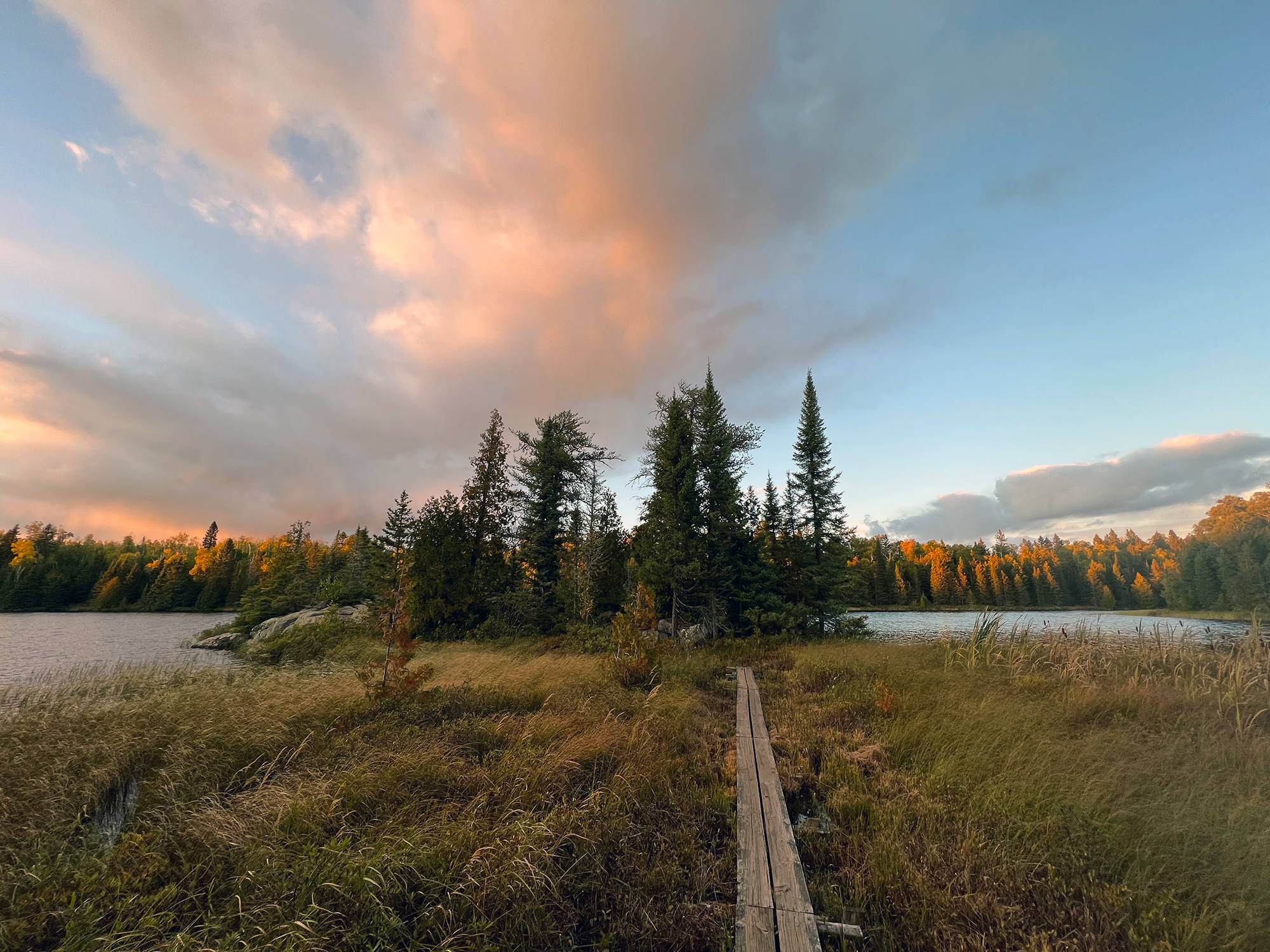
Lily’s Island, Sonju Lake.
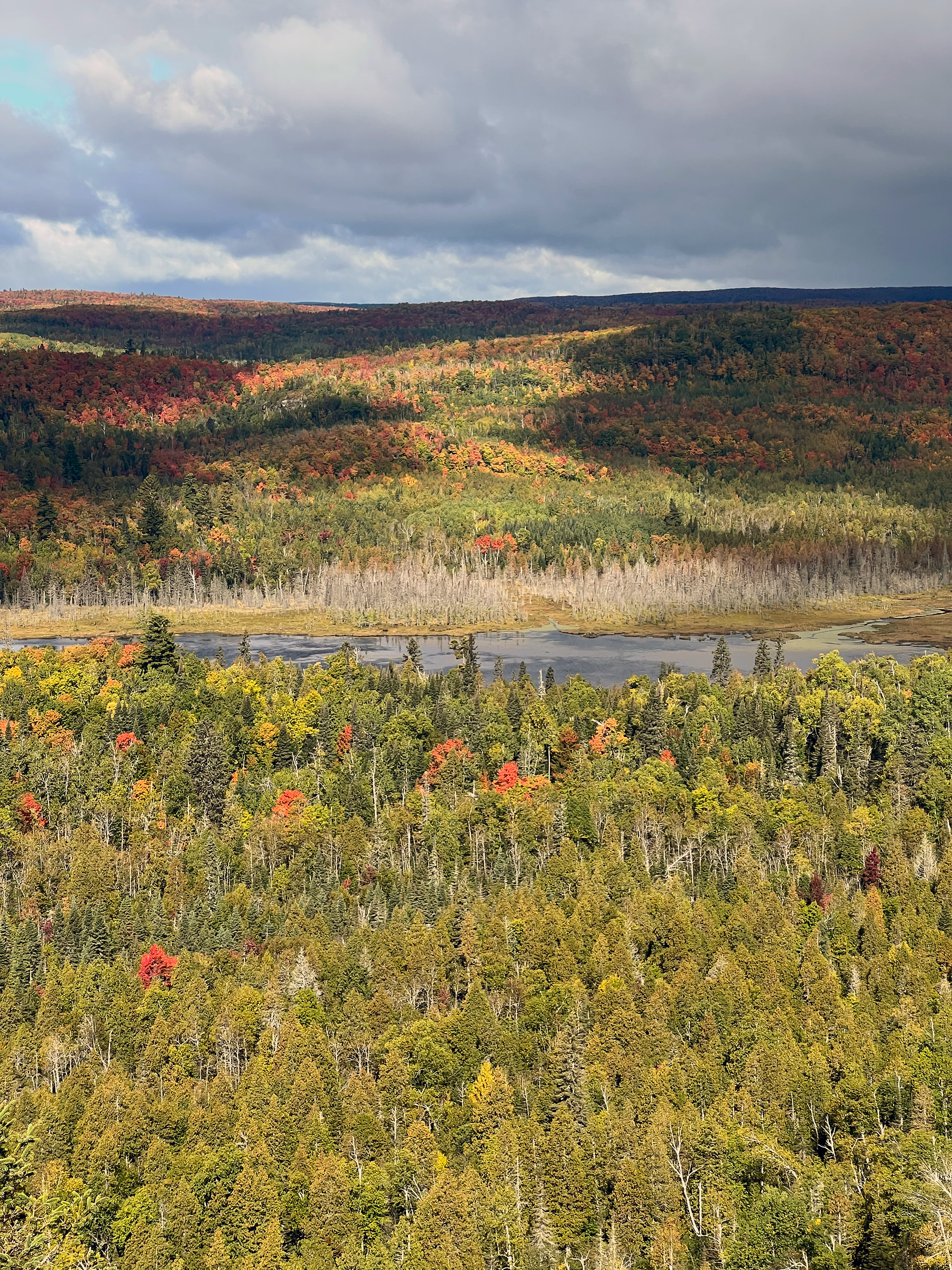
Section 13. Look at that landscape!
Explore the trail.
Interesed in learning more? Join us for one of our online courses. We’ve got courses for beginner backpackers as well as those looking to complete their first thru-hike.
Check out our Google Map highlighting our journey, along with campsites we used as well as points of interest.. Map should not be used for navigation but will help in planning.
Interested in a section or thru hike of the SHT? The Superior Hiking Trail Association has provided great info for planning your next adventure.
We primarily relied on Avenza maps for navigating the trail. You can download a set through the SHT Association or search for the set on the app. I also carried the SHT data book and referred to it almost daily to calculate distance between campsites as well as other points of interest, such as potential water sources.
Highlights! We found the many incredible overlooks, gorges of cascading falls, Mt. Trudee, Sawmill Dome, Section 13, Sonju Lake, Manitou River Gorge, Cross River and Temperance River State Park.
New Gooseberry section is gentle and rolling. It is a mix of hard clay and boardwalk. Hike the clay in the morning when it’s cool. Watch for signs of moose.
Tettegouche State Park reroute is minimally signed. Take spur east, .5 miles down to parking lot trail head. Follow paved road east (towards Lake Superior) approximately 1.5 miles. Take a left on small, single vehicle bridge. Right after bridge, trail will cross under Hwy 61 and connect with opposite side of river. Follow north to High Falls intersection and turn right or back east on SHT. This is NOBO directions. As of Nov 2022, this information does not appear to be on the SHT website.
Pros of autumn hiking: Fall colors, no bugs, fewer hikers on trail (outside of the more touristy areas). Warm, temperate days make for comfortable hiking. Depending on the timing, it can be easier to reserve campsites as needed. Cons: Weather can very wildly and sleet or snow isn’t unusual later in the fall. Cooler temps and potential for rain which means there could be pretty muddy conditions in places.
Bonus! At the end of this series I’ll share my packing list. My backpack started out at 22 pounds with fuel, water and food. Heaviest weight was around 25 pounds.
Disclaimer: Some of the information provided might not be up to date or accurate. You’re responsible to do your own research and planning. Conditions can and will change due to the weather, trail damage and reroutes. The SHT goes through private and public properties. Please respect the rules so we all can continue to enjoy it. Check the SHT Association webpage for updates.